This militarized Island is located in the Parcel Island chain approximately 158 Nautical Miles south of Hainan Island, China and 202 Nautical Miles east from Vietnam. The island is probably the most developed island within the area disputed and claimed by China.
 |
| Parcel Island Chain |
China has developed this island from an atoll to a military outpost harbouring advanced Air Defence Missile Systems and 4th Generation Fighter Aircraft. This heavily defended island from which China can assert its claims over the region. Comment: China tends to recreate the same type of infrastructure for like purposes. Therefore Woody Island is excellent example of what China is or will construct on other man-made islands it is occupying within the contested South China Sea area. Initial indications are the ability to force project air / naval / Air Defence forces of China's PLA.
Select image for larger view
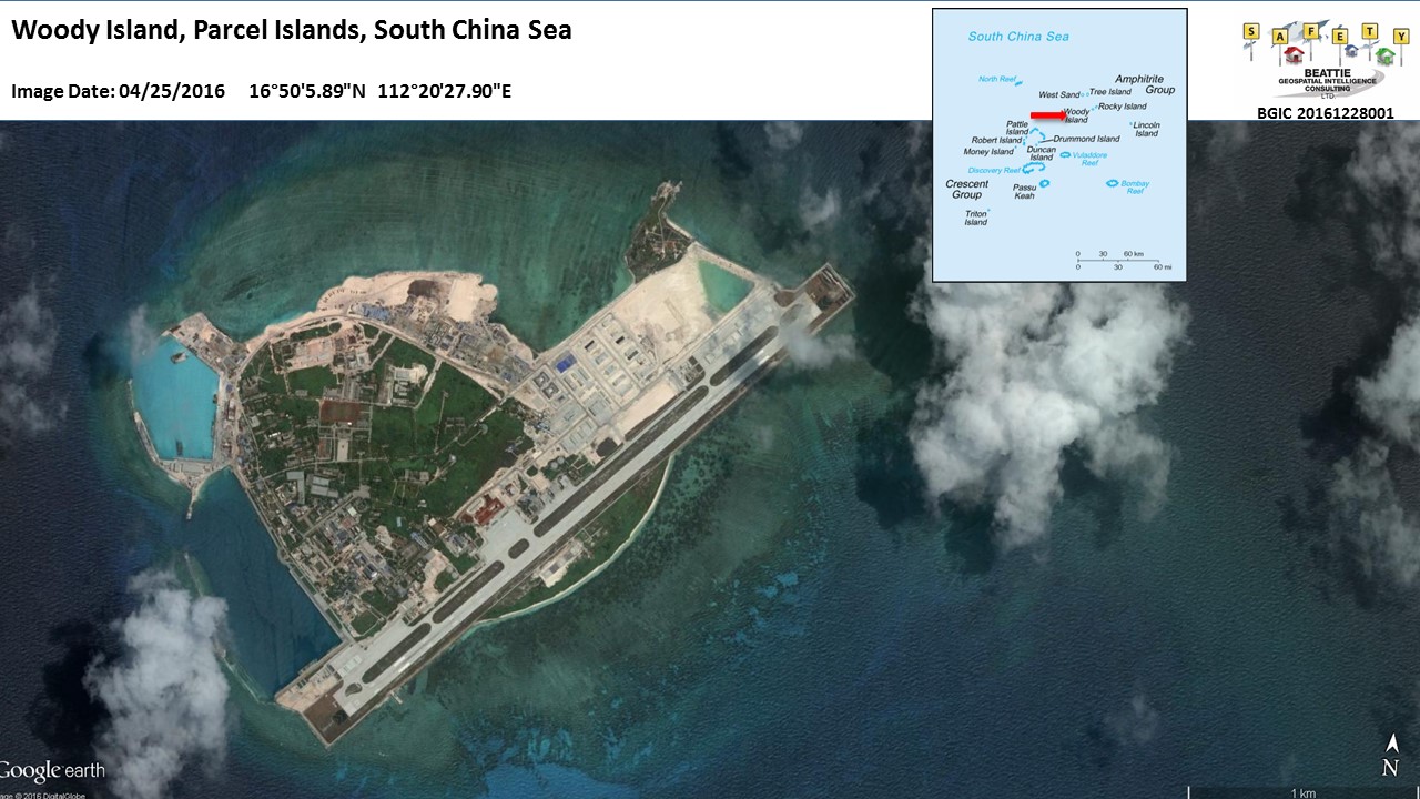
This above image provided via Google Earth from Digital Globe shows the Island as of April 2016. The airfield, harbours and infrastructure is clearly visible. This blog post will show and identify key features of the island's infrastructure along with military equipment observed on the available Digital Globe imagery.
Select image for larger view
 |
| 18 Jan 2005 |
Select image for larger view

2016 imagery acquired on 25 April by Digital Globe shows two Chinese J-11D Multi-role Fighters, they are the Chinese variant of the Russian SU-35 FLANKER E. Runway 23's hangers have sufficient space for 12x J-11D aircraft.
Select image for larger view

On the north-western part of Woody Island 25 April 2016 Digital Globe imagery showed the deployment of eight HQ-9 (S300) Transporter-Erector-Launchers (TEL) and other components of the HQ-9 (S300) advanced Surface to Air Missile (SAM) system. Also observed on the imagery were eight possible Command Post vehicles, one each with every two HQ-9 TEL and other s associated with the systems command and control radars, the HT 231 PESA Engagement Radar, Type 120 Low Altitude and Type 305B acquisition radars.
Select image for larger view
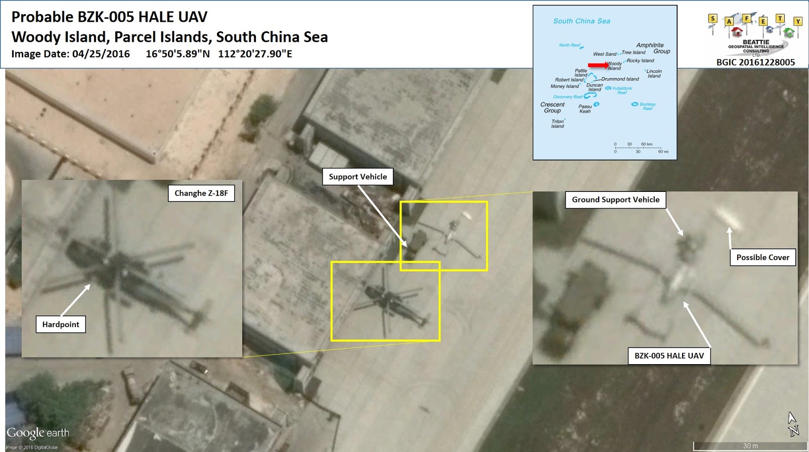
West of the runway and North of the Civilian Terminal apron there is an apron in front to four large two story hangers. Digital Globe imagery showed on 25 April 2016 the presence of one probable BZK-005 High Altitude Long Endurance (HALE) Unmanned Aerial Vehicle. (UAV) parked adjacent to a support vehicle and towed by a ground support vehicle.
This UAV has a reported duration of over 40 hours and a ceiling of 8km, giving it the ability to survey most of the Chinese Claimed South China Sea. The BZK-005 has also been reported as in service with the Peoples Liberation Army Navy (PLAN).
Southwest of the UAV one Changhe Z-18 Medium Lift Helicopter was observed. The Z-18 "F" variant is an anti-submarine aircraft. One of its key features is hard points for weapon systems. The Digital Globe imagery shows a possible hard point just forward of the port side nacelle.
No comments:
Post a Comment